
An easy to moderate trail of approximately 2.2 miles through the Fountain, Lyons and Dakota formations. Includes 2 overlooks and the Persse house. This trail will qualify Scouts for rank and portions of the Orienteering merit badge. A wonderful hike!
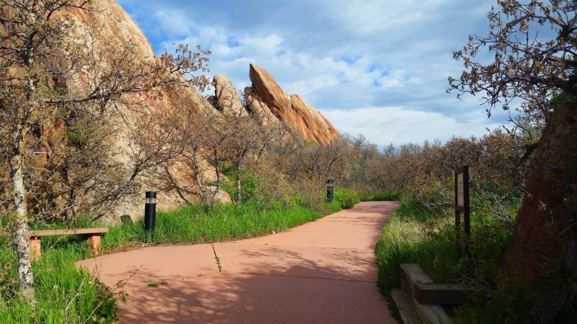
This is a mostly single track, easy effort trail of approximately 1.45 miles through the Fountain, Lykins and Lyons formations. Known for wildflowers and its variety of birds.
This is a moderate hike of approximately 1.83 miles, starting about ½ mile from the visitor center. A nearly 500 foot elevation change crosses the rocky outcrops of the Dakota Ridge Hogback with a northern view of the valley.
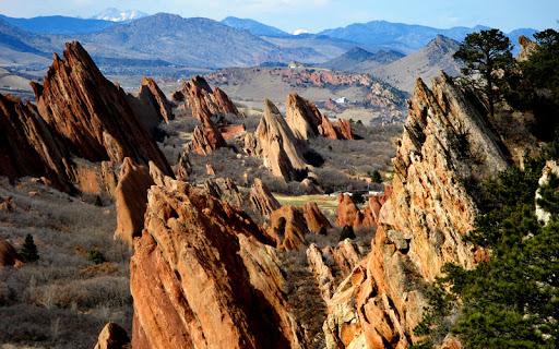
This moderate to strenuous hike begins a little more than ½ mile from the Visitor Center and climbs nearly 1000 feet over approximately 3.25 miles to the top of Carpenter Peak with 50 mile views. This is about a 6.5 mile RDTP. Be Prepared!

The Elk Valley Trail is a moderate trail branching off of the Carpenter Peak trail and starting about 1.7 miles from the Visitor Center. This is a historic trail, giving hikers a glimpse of a favorite of many of the park’s Rangers and Volunteers. Total roundtrip from the visitor center is approximately 7.95 miles. Again, Be Prepared!

This short journey through Douglas County history continues on from the end of Elk Valley and brings you eventually back home! As an extension of the Elk Valley Trail, it uses the map and EV coordinates already found on your map and hike thus far. The homestead portion of this trail will pass by the historical locations and homes of Roxborough’s early pioneers and settlers.
Hoping you’ve had a great day on a Colorado Trail!
